
Orthomosaic mapping missions for DJI drones
The classic mapping flight: a lawnmower-pattern grid with the camera pointed straight down, sized from your target resolution. Draw the area, set your overlap, and export a ready-to-fly DJI KMZ — the bread and butter of drone photogrammetry, without the enterprise price tag.
From target GSD to flight plan
Draw your survey area (or import a KML / GeoJSON boundary) and set either an altitude or a target GSD in cm/px — they're linked through your drone's actual camera geometry, with presets for the Mini 4/5 Pro, Air 3/3S, Mavic 3 series, Mavic 4 Pro and Lito X1 — with the Matrice 300/350 RTK (P1, H20, L1/L2), Mavic 3E/3T/3M and Inspire 3 also supported — plus custom camera profiles. Front and side overlap set the photo and line spacing, the grid angle is yours to type or drag, and the polygon's edges are buffered so coverage reaches all the way to the boundary — concave shapes included.
Waypoint precision or interval speed
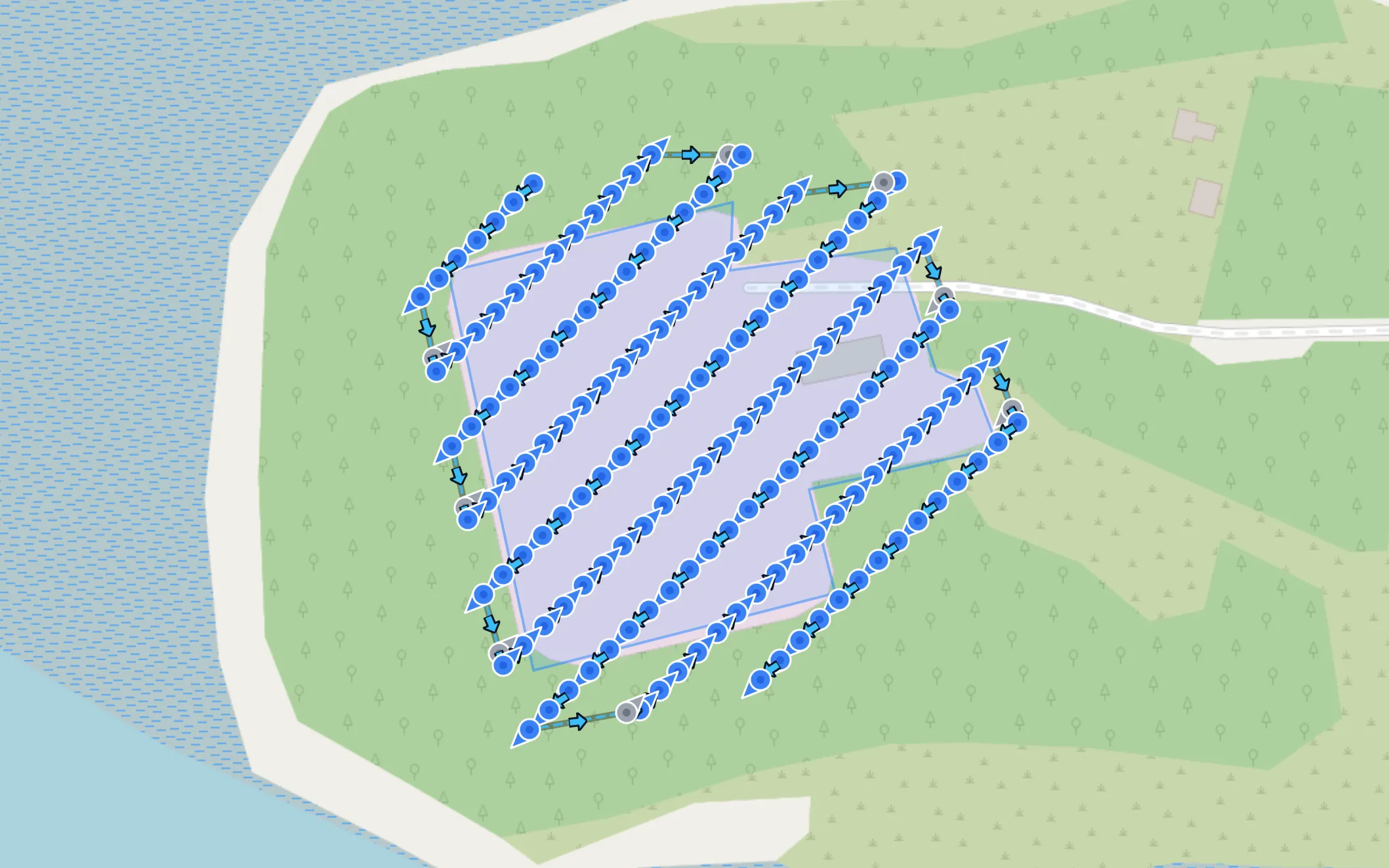
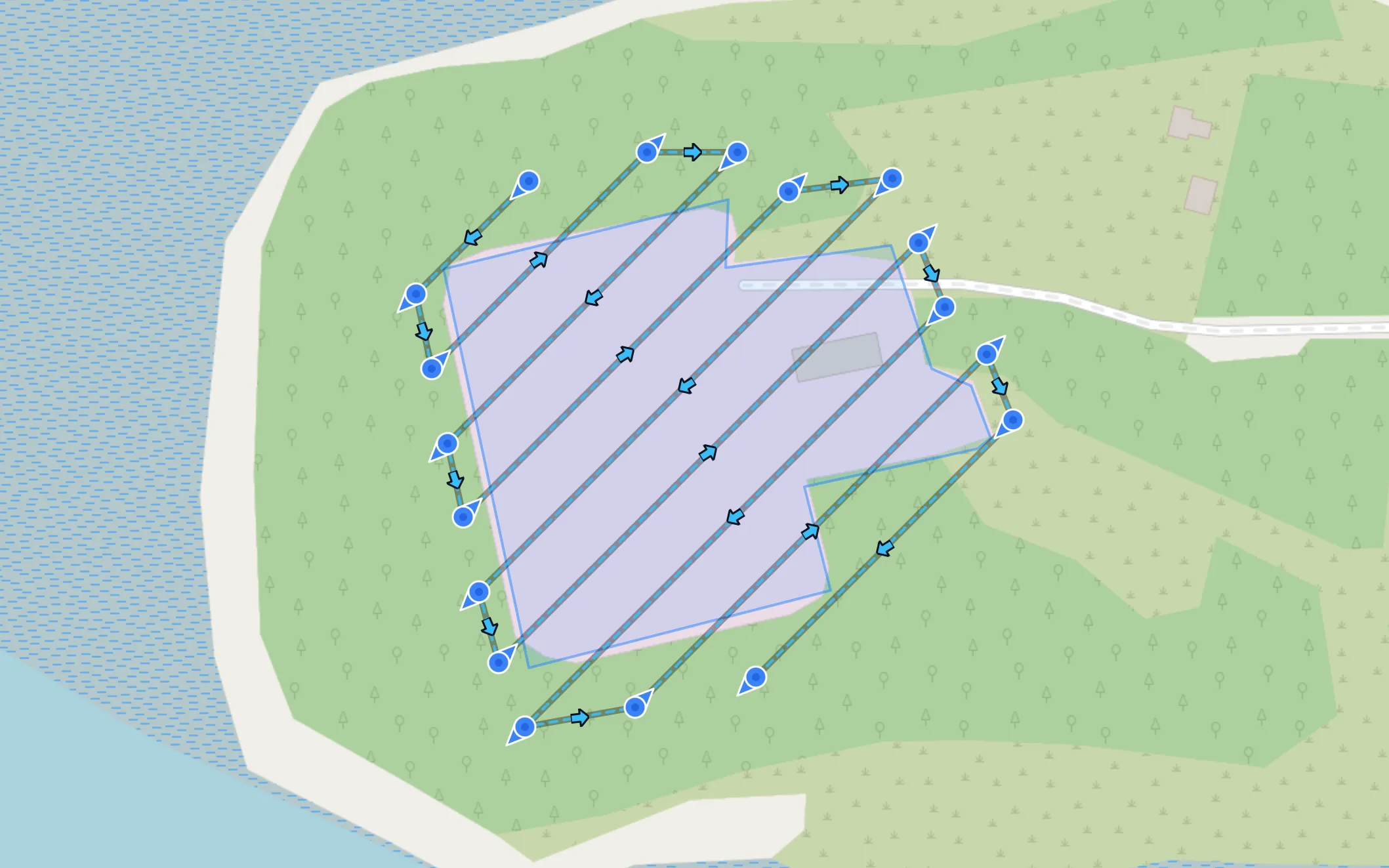
Waypoint capture stops at every photo position — maximum positional precision. Interval capture flies the lines through, shooting on a timer — far faster over large areas, with flight speed derived from your interval and photo spacing. Either way you see waypoint count, photo count and estimated flight time before you commit.
Terrain follow keeps your GSD honest
On sloped sites a fixed altitude means the map's resolution drifts with the ground. With Terrain Follow, each waypoint's height is computed from the elevation beneath it — baked into the exported mission the way consumer DJI drones actually fly (relative to take-off), so no special firmware modes are involved. For finer ground detail than the ~30 m global data, upload a local bare-earth DTM; it's parsed entirely in your browser and becomes the highest-priority elevation source.
Obliques along the way, if you want them
A pure nadir grid reconstructs façades poorly. Enable Intelligent Obliques and the same flight collects angled shots in the directions you choose — a cheap way to make a flat map double as a 3D-capable dataset. For dedicated 3D coverage of a site's perimeter and structures, pair the grid with an Oblique 3D Capture mission.
Plan on your own imagery, not stale satellite tiles
Default basemaps can be years out of date. Drop a GeoTIFF orthomosaic from an earlier flight onto the map — parsed and draped entirely in your browser, never uploaded — and trace your boundary against real, current imagery at far higher resolution than any satellite layer: the new building, the cleared vegetation, the actual fence line. It sits under your flight lines in both 2D and the 3D preview. More on planning with real-world context →
Export and fly
One click exports a DJI KMZ (WPML) mission for DJI Fly — plus an experimental Litchi CSV option in waypoint capture. Missions over your waypoint cap split automatically into numbered flights, and the whole route can be checked in the interactive 3D preview over real terrain first.
Mapping missions, asked and answered
What altitude should I fly for a given map resolution?
You don't have to work it out: type the ground sampling distance you want in cm/px and the altitude is computed from your drone's actual camera — or set the altitude and read off the GSD. The two fields stay in sync.
Does it handle hilly terrain?
Yes — with Terrain Follow on, each waypoint's height is computed from the ground elevation beneath it, so your GSD stays consistent across slopes. You can also upload a local bare-earth DTM for finer ground detail than global data.
Waypoint or interval capture — which should I use?
Waypoint capture stops at each photo position — precise, and required for Litchi export. Interval capture flies through, shooting on a timer — much faster over large areas, at the cost of some positional precision. Both export as DJI KMZ.
Other mission types
Plan your first mapping flight
Create a free account, draw an area and export a mission in minutes.