

Orbit, spiral and column missions for DJI drones
Towers, wind turbines, monuments, chimneys — standalone structures want to be circled, not gridded. Drop a centre point, define your height layers, and fly them as clean orbit rings or one continuous climbing spiral, with the camera on the subject the whole way round.
Layers that fit the structure
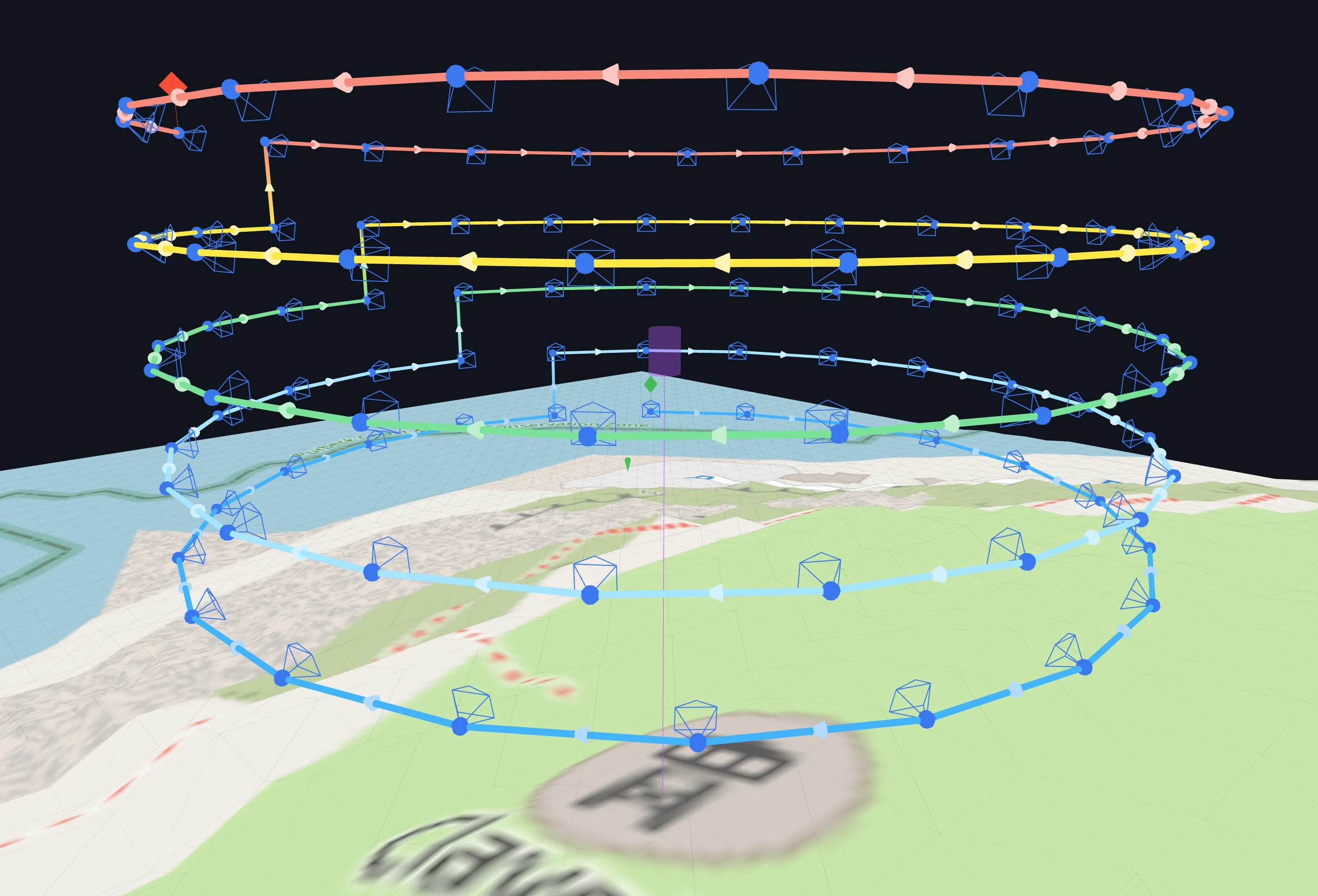
Set a start and end height and the number of layers, and each orbit gets its own height and radius — taper the radii to hug a narrowing tower, or switch to manual layers and type each one in. Side overlap is measured at the subject, so photo spacing on the structure stays what you asked for regardless of radius. Fly bottom-up or top-down, as separate rings or as a continuous spiral that climbs smoothly from one layer to the next.
The camera never loses the subject
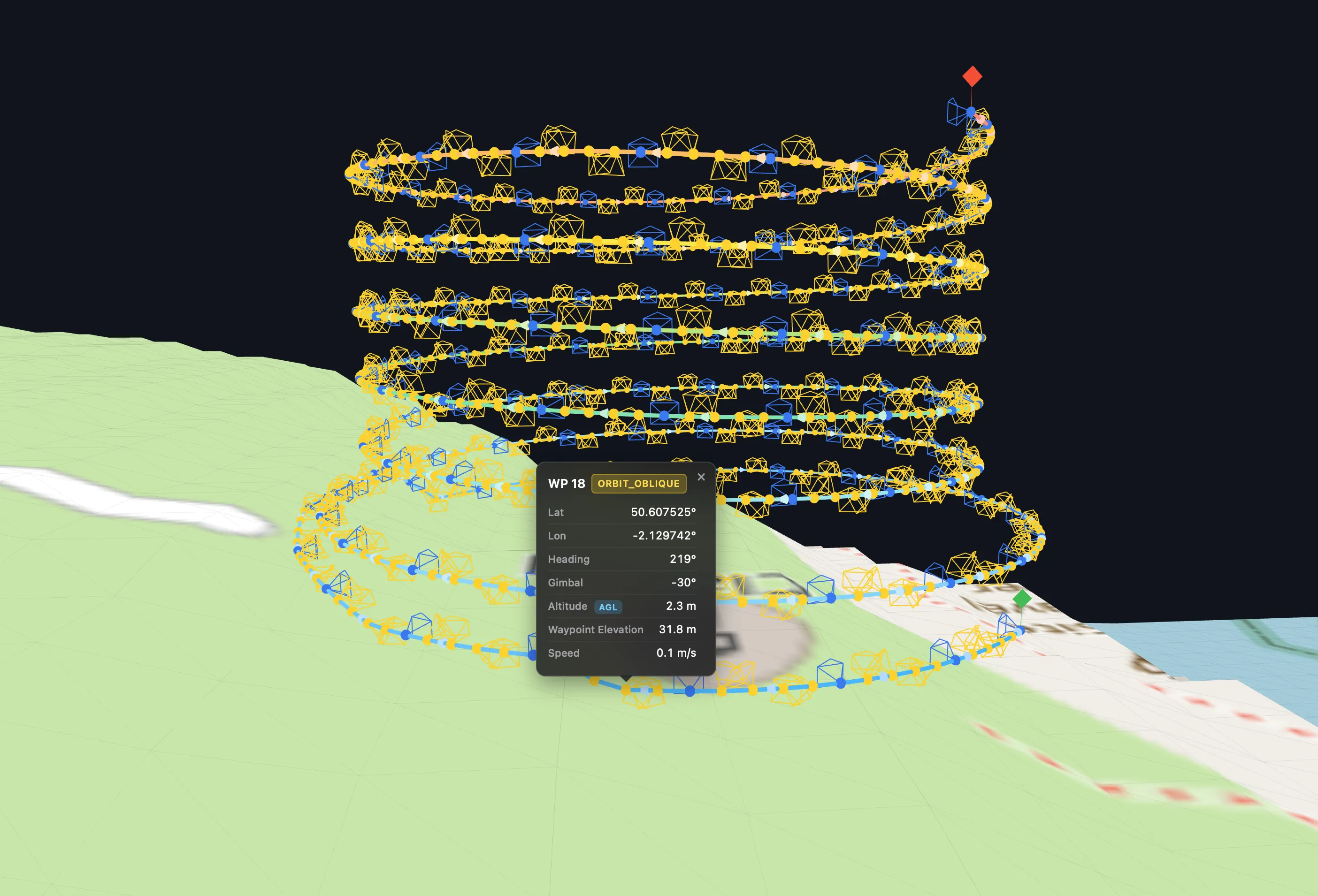
Define the subject as a height band — say, the tower from ground to 30 m — and every waypoint aims into it: tilting up from below the band, level alongside it, down from above, always within your drone's real gimbal limits. Optional Intelligent Obliques add angled shots along the arc between straight-on positions for denser reconstruction coverage.
Terrain-aware around the base
On sloped ground an orbit can dip surprisingly close to the terrain on the uphill side. With Terrain Follow, waypoints that would fall below your minimum height to ground are lifted; with it off, the whole mission is raised so layer heights are measured from the highest ground under the path — predictable either way. A local bare-earth DTM refines the ground model and adds a lateral obstacle clearance check around terrain, processed entirely in your browser.
Check the rings against the surroundings
An orbit's real hazards are usually next to the subject, not the subject itself. Fly a quick oblique pass, mesh it in WebODM or Metashape, and load it as a 3D Model Overlay: the model appears seated on the terrain in the 3D preview, with your orbit rings drawn around it — so the ring that would clip the tree line or the neighbouring rooftop is obvious before take-off, not after. It's a visual check, not an automated one — the overlay never alters the route — and the model is processed entirely in your browser. More on planning with real-world context →
Preview, export, fly
The interactive 3D preview opens automatically after generation, so you see every ring against the real terrain before committing. Export is a standard DJI KMZ (WPML) waypoint mission for the Mini 4/5 Pro, Air 3/3S, Mavic 3 series, Mavic 4 Pro or Lito X1 — and for the Matrice 300/350 RTK, Mavic 3E/3T/3M and Inspire 3 via DJI Pilot 2 — with an experimental Litchi CSV option. Larger structures split automatically into numbered flights at your waypoint cap.
Orbit missions, asked and answered
Can the orbit get tighter towards the top of a tower?
Yes — give the start and end layers different radii and the orbits taper with the structure, or switch to manual layers and set each layer's height and radius individually.
Does the camera stay pointed at the subject?
Yes — define the subject as a height band and every waypoint aims into it: tilting up from below, level alongside, down from above, always within your drone's real gimbal limits.
Orbit rings or a continuous spiral — which is better?
Rings give clean, repeatable layers — good for inspection passes. A spiral climbs smoothly from each layer to the next in one continuous flight, which is faster and produces evenly distributed viewpoints for reconstruction. Both are one toggle apart.
Other mission types
Plan your first orbit
Create a free account, drop a centre point and preview the rings in 3D.