
Enterprise style missions for consumer drones
You no longer need an enterprise rig to get professional survey data. We bring smart, automated flight planning to consumer drones like the Mini 4/5 Pro, Air 3/3S and Mavics. Our app handles the complex obstacle-aware waypoint routing with terrain following for top-down orthomosaics, obliques for a 3D model, or vertical façade scans for structures. Draw your site, dial in your overlap, set your target detail, and download a ready-to-fly KMZ in seconds.
From idea to flight in three steps
Draw your area
Hit Draw Area on the map toolbar. Click out your survey boundary on the map — any shape, any size, even concave. Edit vertices at any time. The planner takes care of the geometry from there.
Configure, generate & export
Select your drone preset, dial in altitude (or target a specific GSD) and your front and side overlap. Hit Generate Mission — flight lines, waypoint count, photo count and estimated flight time calculate instantly. Export a DJI KMZ with one click.
Load it and fly
Transfer the KMZ to your DJI RC2 controller or load it via DJI Fly. The mission runs autonomously — takeoff, survey pattern, RTH — with all your finish actions, global speed and RC-lost settings baked right in.
Choose how you collect
Three core mission geometries. Pick what suits your drone, subject and conditions — or combine them for a complete reconstruction.
Nadir grid mapping
Straight-down lawnmower passes for clean orthomosaics and dense point clouds.
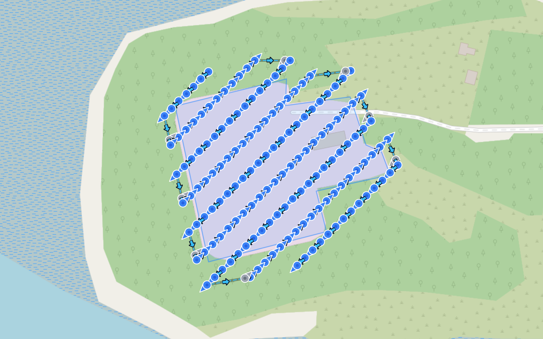
A photo triggers at each waypoint coordinate. The drone can decelerate before each shot for precise timing — ideal in variable wind or at lower cruise speeds.
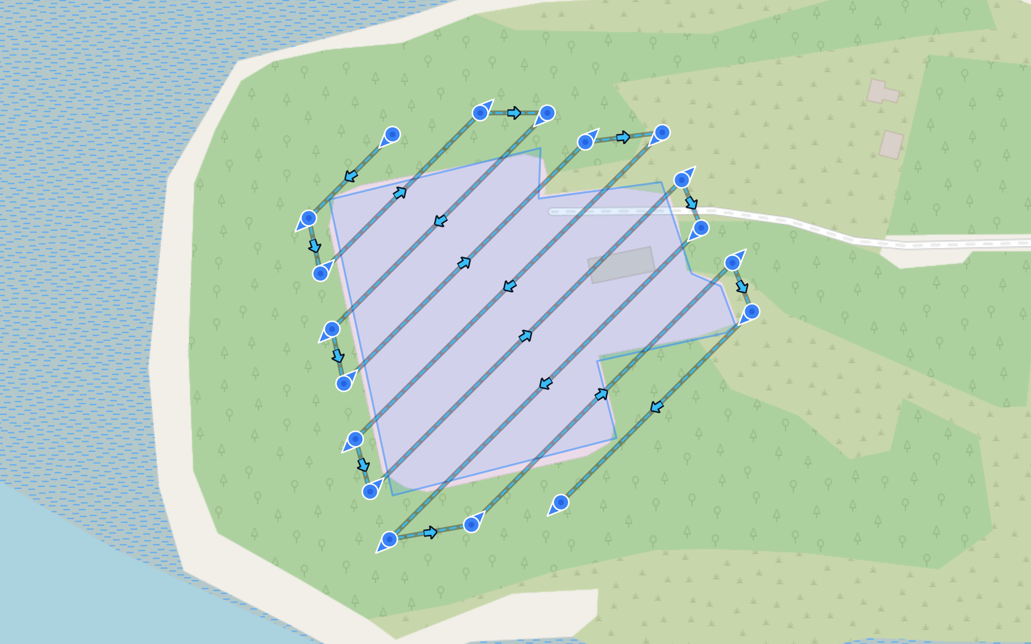
Continuous timed shooting while the drone flies at cruise speed. The planner calculates the speed vs shutter interval ratio from your target front overlap — generally faster but less precise.
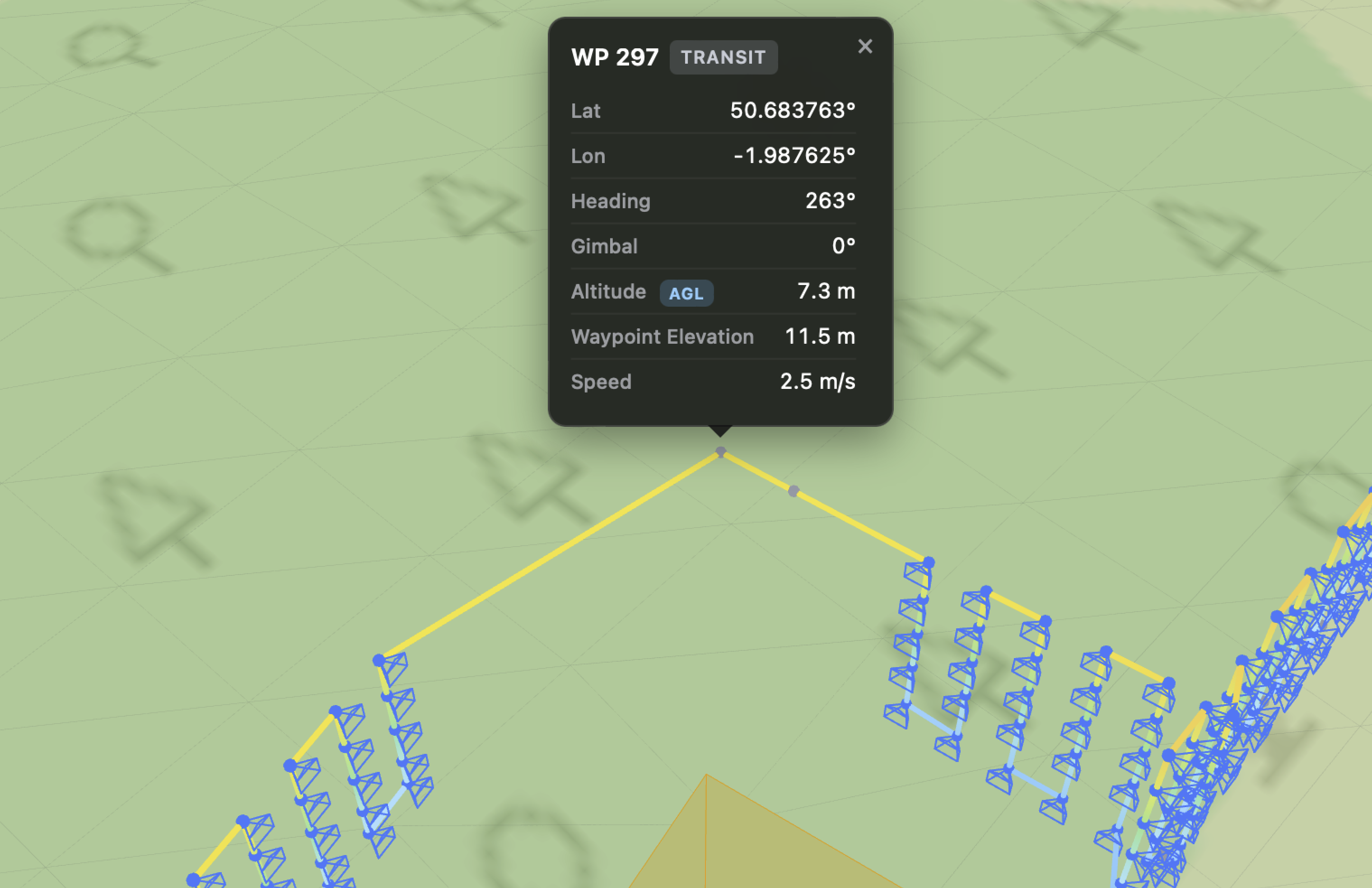
Angled 3D Structure Capture PRO
Pitched-gimbal passes designed to capture facade, wall, and structural details for high-fidelity 3D reconstructions.
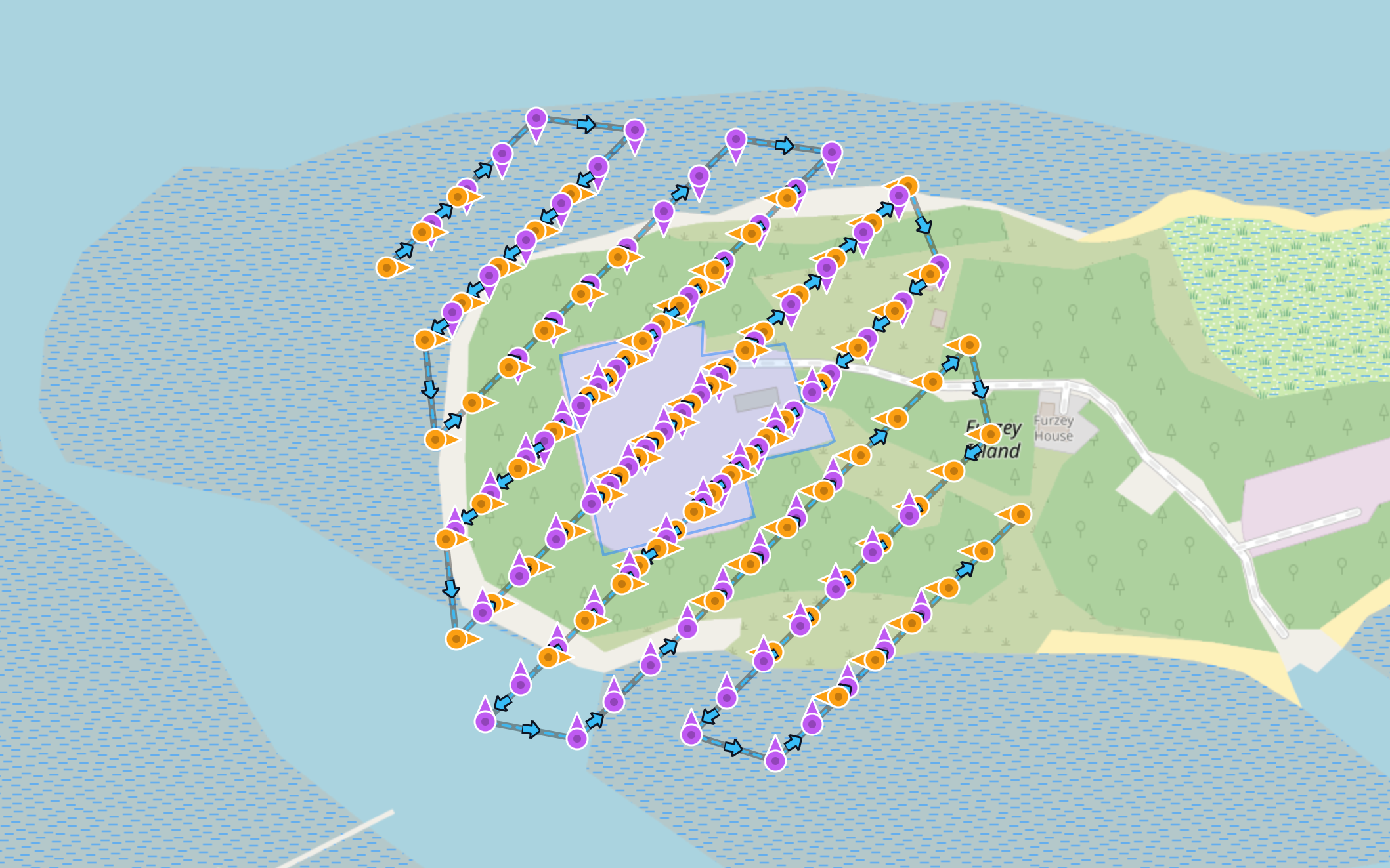
Select from 4 bidirectional axis pairs (like N/S or E/W) and generate an all-in-one lawnmower grid that captures opposite headings in a single battery-efficient flight. The planner automatically extends the lines beyond your drawn perimeter ensuring the vertical edges of your asset get perfect overlap.
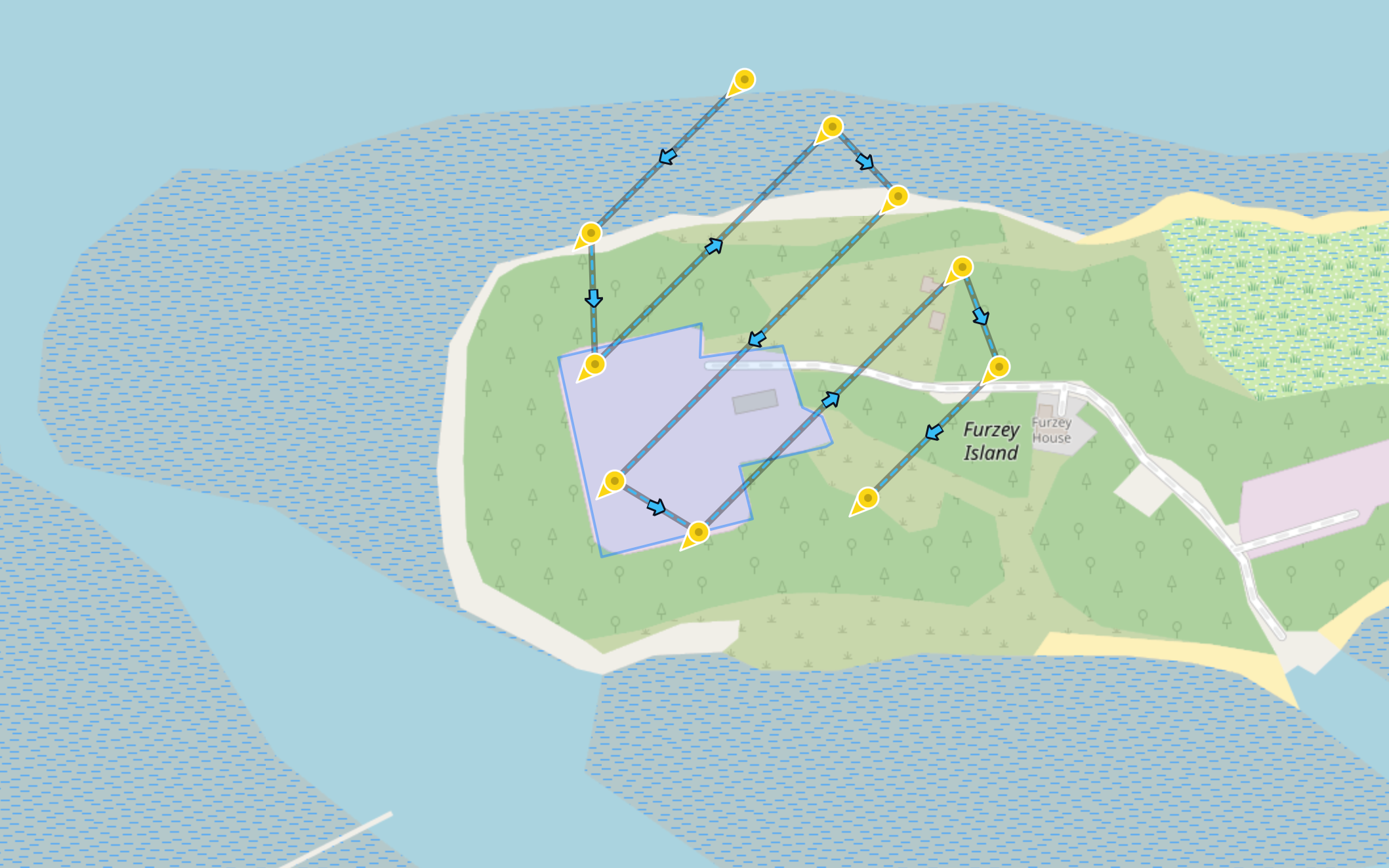
Choose from 8 distinct, absolute cardinal directions. The planner generates a continuous timed-shooting mission where the drone flies the grid layout with its heading locked strictly toward your target direction. Select multiple angles to stitch them together into a seamless flight plan.
Façade Mapping with Intelligent Obliques PRO Beta
Vertical surface & wall inspection — draw a line, polyline or polygon and the planner builds the camera positions to photograph the walls.
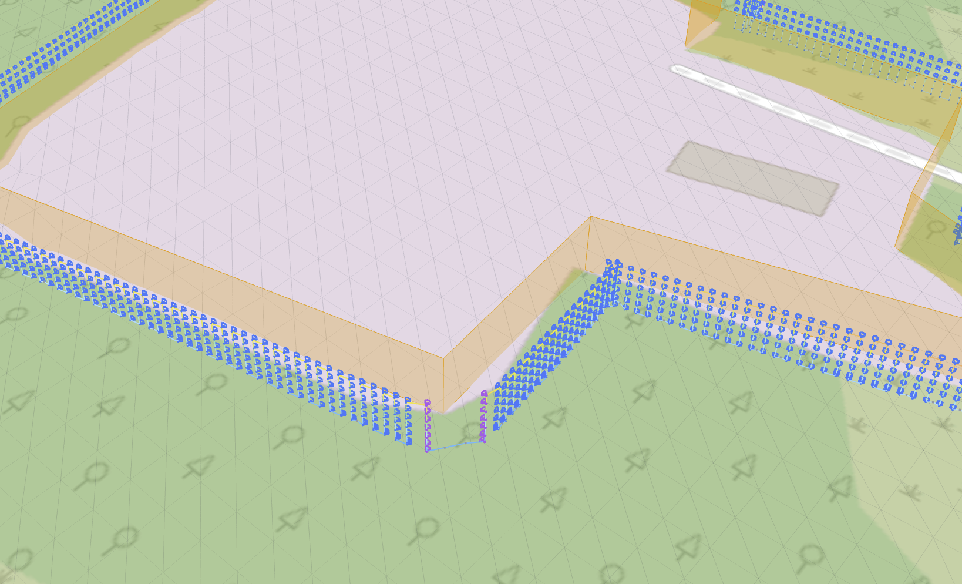
Trace the wall and set a standoff distance (or target GSD) — the planner generates columns of camera stations up and down every surface, with your chosen front and side overlap, automatic corner reconstruction shots, and Intelligent Obliques: each point on the wall can be photographed from up to 8 angled directions plus straight-on, giving reconstruction software the tie points it needs for crisp, complete 3D geometry.
Every flight leg between camera stations is validated against the structure and terrain. Legs that would cut through a wall, graze a corner or dip below the safety floor are automatically repaired with detour waypoints that route around the geometry — honouring your wall clearance and minimum height to ground. Steep terrain is treated as an obstacle too. Verify the whole route in the interactive 3D preview before you fly.
Your site, not a blank map
Bring your own imagery and terrain data into the planner — processed entirely in your browser, never uploaded — and plan against the ground truth.
Orthomosaic Overlay PRO
Drop a GeoTIFF orthomosaic straight onto the map — it's parsed, reprojected and draped entirely client-side (your imagery never leaves your machine). See your actual site, at survey resolution, under your flight lines in both 2D and the 3D preview. Perfect for tracing building footprints and façade lines with pixel accuracy.
Local DTM Import PRO
Upload a site-specific bare-earth DTM — for example from a quick preliminary WebODM survey — and it becomes the planner's highest-priority elevation source. Far finer ground detail than global terrain tiles, sampled per waypoint, and the recommended workflow for accurate façade missions. Like the ortho overlay, it's processed in-browser and never stored server-side.
Advanced mission controls PRO
Small toggles, measurable difference. Each targets a specific real-world problem in drone survey.

3D Mesh Missions
The next chapter: mesh-based flight path generation with full obstacle avoidance. Fly a quick oblique pass to build a rough local 3D mesh of the structure, then let the planner generate a reconstruction flight path that wraps around it — over, under and around every feature — the same workflow enterprise Matrice-series drones use for smart 3D capture. Import your own mesh, or build one from a first pass.
Small details, handled
Ready to plan your next flight?
Create a free account and generate your first mission in minutes.